

Knowledge Centre · Guide · Istanbul ground conditions
Istanbul Ground Conditions: Deep Excavation Area by Area
Istanbul ground conditions change within a few kilometres: soft sediment and fill along the Golden Horn, swelling clays to the west, fractured rock to the north and on the Asian side. In this guide we describe, area by area, the problems that come up most often in deep excavations and foundations, the usual solutions and examples from our own sites.
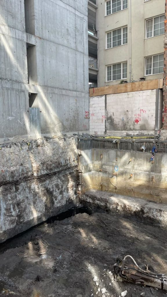
Topic
Ground and deep excavation in Istanbul
Reading time
About 8 minutes
Written by
Abdullah Çetintaş, Geological Engineer
Updated
November 2026
Based on
Peer-reviewed papers and our site experience
Examples
Karaköy and Küçükçekmece
Why are Istanbul ground conditions so variable?
Under the city, units of very different ages and behaviour sit side by side. On the European side, for example, younger clay, sand and limestone layers lie on top of older, fractured rock. Along the coast and in stream beds, in turn, soft sediment and fill cover them.
A 2016 study by Dalgıç and colleagues lists the main conditions that cause foundation problems on the European side. These include low bearing capacity and settlement in young deposits, swelling and earthquake amplification in clayey units, thick fill along the shore and weathering and discontinuities in the rock units.
Important: this guide shows general trends. Even within one district the ground changes from plot to plot; that is why a site-specific investigation always makes the final call.
Istanbul ground conditions: a summary by area
| Area | Dominant ground | Common problem | Usual solution |
|---|---|---|---|
| Golden Horn and the coast | Soft marine sediment and man-made fill | Water inflow, bore collapse, low bearing capacity | Secant piles, jet grout base, cased drilling |
| Stream valleys | Young alluvium: loose sand, silt, organic clay | Settlement, shallow groundwater, liquefaction risk | Piled foundations or ground improvement |
| Western clays | Clayey units such as the Güngören Formation | Swelling, differential settlement, landslides | Long anchors, drainage, staged excavation |
| Limestone areas | Alternating limestone, marl and clay | Solution cavities, marl softening with water | Close-spaced boreholes, tracking concrete use in drilling |
| European side rock zone | Trakya Formation: sandstone, siltstone, shale | Weathering, sliding along joints, dykes | Anchored walls, soil nailing, rock-socketed piles |
| Asian side rock zone | Palaeozoic sandstone, shale, quartzite, limestone | Fractured rock, shale weathering, hard quartzite | Soil nailing, anchors, suitable drilling tools |
The Golden Horn and the coast: soft sediment, fill and water
Soft marine sediment lies along the shores of the Golden Horn (Haliç). For example, in boreholes between Unkapanı and Azapkapı, Meriç and colleagues found Holocene deposits between 14 and 30 m thick. Dalgıç and colleagues also point to the thick fill along the shoreline.
Here the groundwater sits at sea level. So water is the main problem in excavation: it comes in through the base and the sides, and unsupported bores collapse. In addition, old building debris such as brick and rubble can turn up in the fill.
In Karaköy, for instance, we built a secant bored pile wall on a narrow waterfront plot and sealed the base with jet grouting. As a result, the contractor could build the foundation in a dry excavation about 4 m below sea level.
Stream valleys: young alluvium and liquefaction risk
Young stream deposits, in other words alluvium, fill the floors of valleys such as Kurbağalıdere in Kadıköy and the Ayamama and Kağıthane streams on the European side. These layers can contain loose sand, silt and organic clay. Also, the groundwater is usually shallow.
Dalgıç and colleagues note that young deposits such as alluvium and fill can lack bearing capacity and cause settlement problems. In addition, saturated loose sand carries a liquefaction risk in an earthquake. Therefore, a liquefaction assessment under the Turkish Building Earthquake Code (TBDY 2018) matters especially on these sites.
The usual solution is a piled foundation or ground improvement such as jet grouting or deep soil mixing. During excavation, however, you also need cased drilling and a water management plan.
We also explain in short videos how alluvium behaves in an earthquake and what liquefaction is. However, the footage may be sample material for educational purposes.

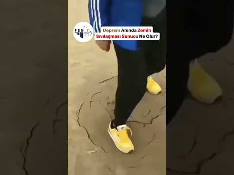
You can find all our videos on our YouTube and Instagram accounts.
The western districts: swelling clays and landslides
Clay-rich units such as the Güngören Formation are widespread around Avcılar, Küçükçekmece and Beylikdüzü. According to Dalgıç and colleagues, these units can cause earthquake amplification, swelling and differential settlement.
There are also landslides on the slopes between the two lakes; Dalgıç, Turgut and Kuşku studied the factors that prepare and trigger them. For this reason, drainage and slope stability analysis matter in sloped excavations.
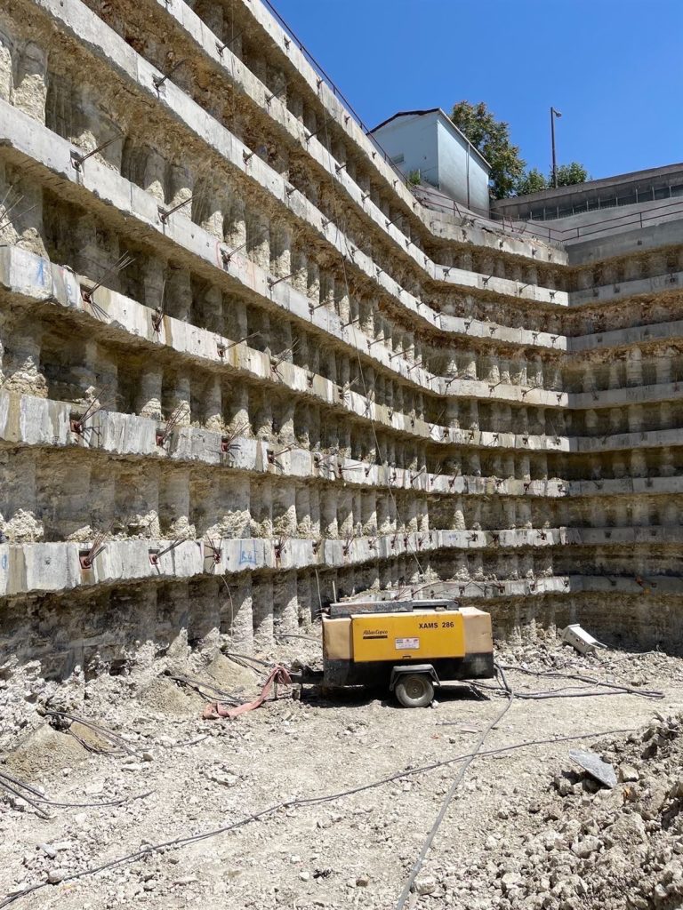
In clay, an anchor’s bond length transfers less friction than in sandy ground; consequently, anchors get longer. In the deep excavation in Küçükçekmece, for example, we supported a wall of 200 bored piles with 800 prestressed anchors in clay. The total anchor length reached 30,000 m.
Limestone areas: cavities and marl
Alternating limestone, marl and clay are common around Bakırköy and Zeytinburnu. Limestone can contain solution cavities; for example, Dalgıç and colleagues point to karst cavity zones in the Eocene Kırklareli Formation.
Drilling into a sudden cavity means a sudden jump in concrete use. That is why these areas call for close-spaced boreholes and for tracking concrete use pile by pile during drilling. Also, marl can soften on contact with water; as a result, drainage and waterproofing become important in basements.
Rock zones: weathering, joints and hard drilling
Sandstone, siltstone and shale of the Trakya Formation underlie the area around Beyoğlu, Şişli, Beşiktaş, Kağıthane and Sarıyer. Dalgıç and colleagues note that weathering, discontinuities and dykes can cause problems in these rocks. In other words, rock quality can change from metre to metre.
The most common problem in excavation is rock wedges sliding along joints and bedding planes. So as the dig goes on, you need to check the orientation of discontinuities and support the face quickly with anchors, soil nails and shotcrete.
On the Asian side, by contrast, Palaeozoic sandstone, shale, quartzite and limestone units occur around Ümraniye, Ataşehir, Kartal and Pendik. Shale can weather quickly once exposed to air and water; for this reason, you should not leave the excavation face open for long. Quartzite, on the other hand, is very hard and abrasive, so we choose drilling tools to suit it.
Istanbul ground conditions and the site investigation
This table is a starting point, but the site investigation decides the project. That is because fill thickness, depth to rock and groundwater can change even within one street.

- Boreholes: should go deeper than the excavation and the piles.
- Groundwater: measure the level and assess it for the excavation period.
- Laboratory: swelling in clay, strength and discontinuity data in rock.
- Earthquake: ground class under TBDY 2018 and, where needed, liquefaction analysis.
- Adjacent buildings: the depth and condition of neighbouring foundations.
If you do not have a site investigation yet, we can arrange one together with our drilling partner.
Frequently asked questions about Istanbul ground conditions
We have collected the questions about ground in Istanbul that we hear most often. However, if yours is not here, call us or write through the quote form.
Istanbul ground conditions by area
Where is the firmest ground in Istanbul?
In general, areas where rock lies close to the surface cause fewer problems. However, weathering and joints can be a problem in rock too. That is why you should look at the site investigation, not the name of the district.
Is the ground on the European side bad?
No, that generalisation is wrong. The European side has both firm rock and soft sediment. A site-specific investigation makes the call.
Can you build a basement on the waterfront?
Yes, but you need shoring that cuts off the water. In Karaköy, for example, secant piles and a jet grout base made it possible to build the foundation in a dry excavation about 4 m below sea level.
What does swelling clay do to a building?
Clay swells as it takes on water and shrinks as it dries. This movement can cause differential settlement and cracks in the foundation. Therefore, drainage and a suitable foundation depth matter on clay sites.
Can a map of Istanbul ground conditions replace a site investigation?
No. Maps such as microzonation studies show general trends; however, you still need to design the project with site-specific borehole and laboratory data.

Sources
- Dalgıç, S. et al. (2016). The effect of soil and rock conditions on construction foundations on the European side of Istanbul. Uygulamalı Yerbilimleri Dergisi, 8(2), 47–70 (in Turkish)
- Meriç, E. et al. (2003). New findings on the Holocene deposits in the Golden Horn (Istanbul) coastal area (Unkapanı–Azapkapı). Yerbilimleri, 28, 9–32
- Dalgıç, S., Turgut, M. and Kuşku, İ. The Evaluation of Preparative and Triggering Parameters on Occurrence of Landslides in the Büyükçekmece–Küçükçekmece (DergiPark)
Let us review the ground on your plot together
Send us your site investigation and architectural design. Then let us discuss the excavation and foundation options together with our design partner.